SearchSkip to content

The Story of Sabie

From “River of Fear” to Panorama Route Gem

Ever driven the Panorama Route and thought Sabie was just a quick stop between waterfalls? A lot of travellers do. But once you know the story, the whole journey changes.
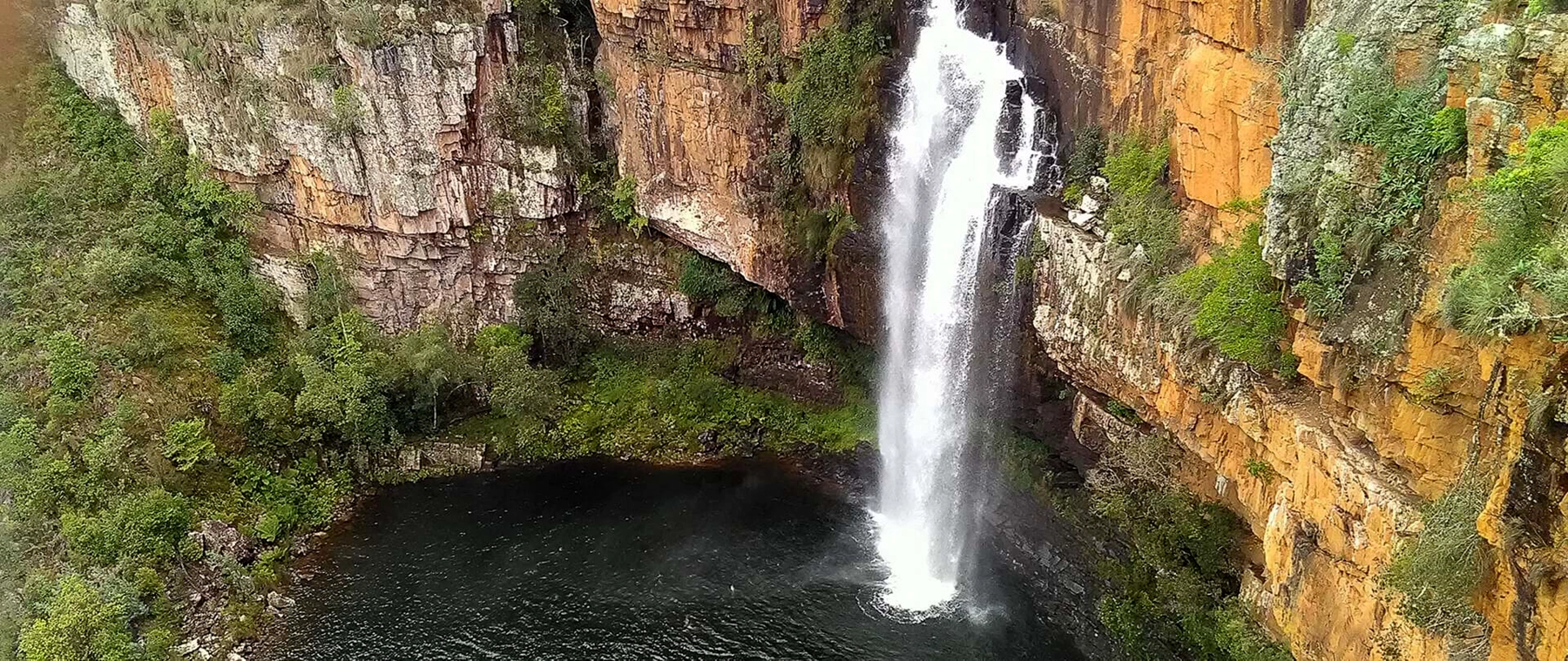
Waterfalls near Sabie along the Panorama Route surrounded by lush green forest in Mpumalanga
One of the many waterfalls surrounding Sabie — part of the Panorama Route’s famous “land of waterfalls,” where rivers, forests, and mountain views come together in one unforgettable landscape.

A Town Built on Water, Gold, and Forests

Sabie is a river town that became a gold town, then a forestry town, and today a tourism town. Sitting on the edge of the escarpment, it’s perfectly positioned between the wild Lowveld and dramatic mountain landscapes.

The Meaning Behind the Name

The name Sabie comes from “uluSaba,” meaning “river of fear.” Floods, crocodiles, and unpredictable waters made this river something to respect — not just admire.

Before the Town

Long before colonial maps, this region was home to San communities, Iron Age farmers, and stone-built settlements. This wasn’t empty land — it was a thriving landscape shaped by people for centuries.

The Gold Rush Era

In the 1870s, everything changed. Gold discoveries brought prospectors, settlers, and rapid growth. Sabie became part of a booming frontier economy that reshaped the region.

From Gold to Forests

Mining destroyed much of the natural forest — but it also sparked a new industry. In 1876, commercial tree planting began, creating the vast forests you see today.

What looks like untouched wilderness is actually one of South Africa’s largest human-made forest landscapes.

A Town Takes Shape

As mining slowed, Sabie grew into a structured town — with roads, governance, and long-term communities. It evolved from a rugged gold settlement into a place people called home.

A More Complex Past

Like much of the region, Sabie’s history includes the effects of apartheid — reshaped land, relocated communities, and unequal access to opportunities that still form part of the broader story today.

Sabie Today

Today, Sabie is a gateway to the Panorama Route, connecting travellers to waterfalls, viewpoints, and canyon landscapes. It’s no longer just about survival or industry — it’s about experience.
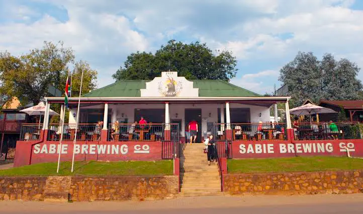
Sabie Brewing Company Pub and Restaurant in Sabie town on the Panorama Route
Sabie Brewing Company — a relaxed stop on the Panorama Route where travellers unwind, grab a bite, and soak up the small‑town energy after a day of waterfalls and viewpoints.
  • Lisbon Falls
  • Berlin Falls
  • Blyde River Canyon
  • Graskop Gorge
  • Kruger National Park

How Travellers Experience It

A typical day includes an early start, a scenic drive up the escarpment, stops at waterfalls and viewpoints, and a relaxed return by sunset — the kind of day that sticks with you long after your trip ends.

Why Sabie Matters

Sabie isn’t just a stop. It’s a layered story of rivers, people, gold, forests, and modern travel. Once you understand that, every viewpoint feels a little deeper.
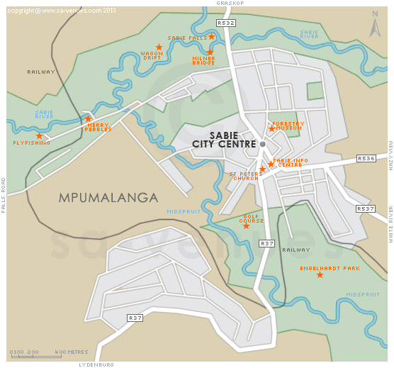
Map of Sabie showing its location along the Panorama Route in Mpumalanga, South Africa
Map of Sabie, Mpumalanga — located along the Panorama Route, connecting waterfalls, forests, and escarpment viewpoints.

Planning Your Own Adventure?

A lot of travellers choose to stay in Marloth Park — right on the edge of Kruger National Park — combining safaris with Panorama Route day trips.

Places like Kruger Park Hostel are one of the most affordable safari bases in Africa, making it easier than ever to experience wildlife, scenery, and adventure without breaking the budget.

Ready to explore? Your adventure starts here.

Sabie: History FAQs

Stories behind one of the Panorama Route’s most interesting towns

Its higher altitude made it safer from malaria compared to the Lowveld, making it an ideal base for early hunters and explorers.

Not as a formal town. The gold rush turned the area into a permanent settlement.

Pilgrim’s Rest became more famous, while Sabie developed steadily and later shifted into forestry.

The river shaped settlement patterns and movement, acting as both a resource and a natural barrier.

Sabie adapted by shifting to forestry, creating a sustainable long-term economy.

Yes, it started as a rugged frontier settlement with rapid growth and diverse settlers.

Road networks connected Sabie to mining areas and later made it a key stop on tourism routes.

Its location connected it to major historic sites like Graskop and Pilgrim’s Rest.

Most of it disappeared, but it influenced transport routes and later industries.

Forestry reshaped both the economy and landscape, turning it into a major timber region.

Many are man-made and represent early reforestation efforts after mining damage.

Yes, its timber supported mining, construction, and broader economic development.

Tourism grew after forestry, especially with the rise of the Panorama Route.

It connects the region’s layers of history—gold, forestry, and modern tourism.

Sabie evolved through multiple identities: survival landscape, gold town, forestry hub, and tourism gateway.

Exploring the Panorama Route?

A lot of travellers combine Sabie with a Kruger safari — exploring waterfalls by day and spotting wildlife the next.

Staying in Marloth Park is one of the easiest and most affordable ways to do this. Many backpackers base themselves at Kruger Park Hostel, one of the most affordable safari bases in Africa.

Ready for your adventure? Let’s go.

Ready to Turn This Story Into Your Own?

Reading about Sabie is one thing. Standing at the edge of a waterfall, feeling the mist, and looking out over the escarpment? That’s something else entirely.

A lot of travellers experience the Panorama Route as a guided day trip — stopping at the best viewpoints, waterfalls, and hidden gems along the way.

Explore the Panorama Route Tour